
MAPS OF GALEY PARISH
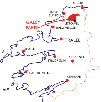
Location Map of Galey Parish
" This parish is bounded on the north-west and north by the parishes
of Lisselton and Aghavallen, on the east and south by those of Murhur and
listowel, and on the west by that of Rattoo."
[From The Antiquities of County Kerry by John O'Donovan (1841)]
Townlands of Galey Parish
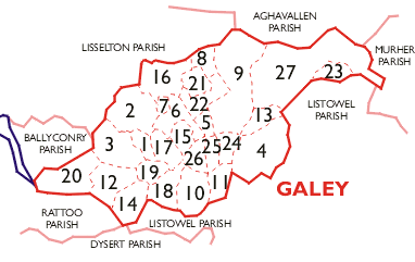
| Number |
Townland |
| 1 | Affoulee |
| 2 | Ballydonohue |
| 3 | Ballyegan |
| 4 | Bedford |
| 5 | Carhoonaknock East |
| 6 | Carhoonaknock West |
| 7 | Coolard |
| 8 | Coolbeha |
| 9 | Coolkeragh |
| 10 | Derra East |
| 11 | Derra West |
| 12 | Dromalught |
| 13 | Drombeg |
| 14 | Drommurrin |
| 15 | Garryard |
| 16 | Glouria |
| 17 | Inch East |
| 18 | Inch Moor |
| 19 | Inch West |
| 20 | Kilteean |
| 21 | Knockenagh North |
| 22 | Knockenagh South |
| 23 | Pollagh |
| 24 | Shrone East |
| 25 | Shrone Middle |
| 26 | Shrone West |
| 27 | Tullamore |
[Last updated: 12-Jul-2004 08:28 PM - Laurence Jones]